

 For all latest articles, follow on Google News
Geography is a field of study that delves into the intricate connections between people, places, and the environment. It encompasses a wide range of topics, from physical landscapes and natural phenomena to human societies and their interactions. Through the lens of geography, we can unravel the complexities of our world and gain a deeper understanding of the processes that shape it. In this article, we will embark on a captivating journey through the realms of geography, exploring various subfields and highlighting the significance of this discipline in comprehending our dynamic planet.
Table of contents
- Introduction to Geography: Unraveling the World Around Us
- Physical Geography: Unveiling Earth’s Natural Features
- Human Geography: Unveiling the Patterns of Human Interaction
- Geographical Techniques: Tools for Analysis and Representation
- Geography and Global Challenges: Addressing Contemporary Issues
- The Future of Geography: Emerging Trends and Possibilities
- Geospatial Technologies: Advancements and Innovations
- Big Data and Data Visualization: Exploring Vast Information Resources
- Geoethics: Nurturing Ethical Conduct in Geographical Research
- Interdisciplinary Approaches: Bridging the Gaps between Disciplines
- Engaging the Youth: Fostering Geographical Curiosity and Knowledge
- Conclusion
- Bibliography
Introduction to Geography: Unraveling the World Around Us
Geography is a discipline that strives to uncover the mysteries of our planet and unravel the world around us. It provides us with a framework to comprehend the spatial dimensions of our environment, including the physical features, natural systems, and human activities that shape the Earth. By examining the interplay between these elements, geography enables us to gain insights into the intricate relationships between humans and their surroundings.
Defining Geography: The Study of Earth and Its Systems
At its core, geography is the study of the Earth and its various components. It encompasses both the physical and human aspects of the planet, examining how they interact and influence one another. Physical geography focuses on landforms, climate, ecosystems, and natural processes, while human geography delves into the spatial patterns of human activities, such as population distribution, cultural diversity, and economic systems.
Key Concepts and Approaches in Geography
Geography employs several key concepts and approaches to analyze the world. These include spatial analysis, which examines the arrangement and distribution of phenomena across the Earth’s surface, and scale, which considers the varying levels of geographic inquiry, from local to global. Additionally, geography utilizes both qualitative and quantitative methods, combining fieldwork, data analysis, and mapping techniques to explore and understand spatial relationships.
The Importance of Geography in Our Lives
Geography is essential for comprehending the complexities of our world and addressing a range of global challenges. It helps us understand the distribution of resources, the impacts of climate change, patterns of migration, and the dynamics of urbanization. By studying geography, we can make informed decisions about sustainable development, disaster management, and resource allocation, ensuring a harmonious coexistence between humans and the environment.
Physical Geography: Unveiling Earth’s Natural Features
The physical geography of our planet encompasses the vast array of landforms, bodies of water, climate patterns, and biomes that shape our environment.
Landforms: Mountains, Plateaus, and Plains
Landforms are the result of tectonic forces, erosion, and weathering processes over millions of years. Mountains, plateaus, and plains are the primary landforms found across the Earth’s surface, each with distinct characteristics and influences on climate, ecosystems, and human settlement patterns.
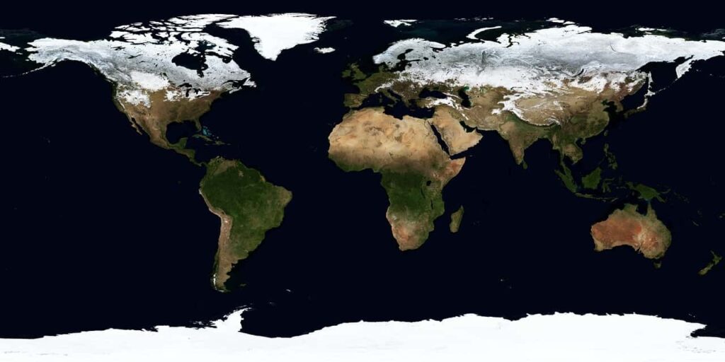
Oceans and Seas: Mighty Water Bodies
Oceans and seas cover around 71% of the Earth’s surface and play a crucial role in regulating climate, supporting marine life, and facilitating global trade and transportation. They exhibit unique physical features, such as currents, tides, and the formation of diverse ecosystems.
Rivers and Lakes: Lifelines of the Planet
Rivers and lakes are vital freshwater resources that sustain life on Earth. They shape landscapes by carving out valleys, providing habitats for a variety of species, and serving as sources of water for human consumption, agriculture, and industry. Rivers also play a significant role in transportation and energy generation through the use of hydropower.
Climate and Weather: Understanding Atmospheric Phenomena
Climate and weather patterns are fundamental aspects of physical geography. Climate refers to long-term patterns of temperature, precipitation, and atmospheric conditions, while weather focuses on short-term variations in these elements. Understanding climate and weather patterns helps us predict and prepare for natural disasters, manage agricultural practices, and assess the impacts of climate change.
Biomes: Ecological Zones and Biodiversity
Biomes are large-scale ecological zones characterized by distinct climate, vegetation, and wildlife. From tropical rainforests to deserts, grasslands to tundras, each biome supports unique ecosystems and plays a vital role in sustaining biodiversity. The study of biomes allows us to comprehend the distribution of species, their adaptations to different environments, and the conservation of fragile ecosystems.
Human Geography: Unveiling the Patterns of Human Interaction
Human geography explores the ways in which humans interact with and shape the world around them. It examines the spatial patterns of population, urbanization, culture, economy, and politics.
Population Geography: Distribution, Density, and Migration
Population geography focuses on the distribution, density, and migration of human populations across the globe. It investigates factors influencing population growth, such as fertility rates, mortality rates, and migration patterns. Understanding population dynamics is essential for urban planning, resource management, and sustainable development.
Urban Geography: Cities as Centers of Human Activity
Urban geography studies the spatial organization, growth, and socio-economic dynamics of cities. It explores the functions of urban areas as hubs of commerce, culture, and governance, and examines the challenges associated with urbanization, including infrastructure, housing, and environmental sustainability.
Cultural Geography: Language, Religion, and Identity
Cultural geography examines the spatial distribution of cultural traits, including language, religion, customs, and traditions. It explores how cultural landscapes shape human perceptions, identities, and interactions. Cultural geography provides insights into the processes of cultural diffusion, assimilation, and the preservation of cultural heritage.
Economic Geography: Resources, Trade, and Development
Economic geography investigates the spatial distribution of economic activities, including the production, distribution, and consumption of goods and services. It analyzes factors that shape regional economic disparities, such as access to resources, infrastructure, trade networks, and policies. Economic geography contributes to the understanding of global trade, industrial development, and regional economic integration.
Political Geography: Borders, States, and Geopolitics
Political geography explores the spatial organization of political systems, borders, and states. It investigates geopolitical dynamics, including territorial disputes, alliances, and power struggles. Political geography plays a crucial role in understanding international relations, conflicts, and the impacts of political decisions on local and global scales.
Geographical Techniques: Tools for Analysis and Representation
Geographical techniques provide the tools and methods necessary for analyzing and representing spatial data. These techniques aid in understanding the patterns, processes, and relationships within the field of geography.
Maps and Cartography: Visualizing Spatial Data
Maps and cartography are fundamental tools in geography, enabling the visual representation of spatial data. They provide a means to communicate information about the Earth’s surface, including topography, land use, population distribution, and more. Cartographic techniques continue to evolve, incorporating advanced technologies for accurate and interactive map production.
Remote Sensing and GIS: Gathering and Analyzing Geographical Information
Remote sensing involves the acquisition of data about the Earth’s surface from satellites, aircraft, and other platforms. It provides valuable information about land cover, vegetation, urban development, and environmental changes. Geographic Information Systems (GIS) integrate and analyze spatial data, enabling the identification of patterns, modeling, and decision-making processes.
Fieldwork and Surveys: Gathering Primary Data
Fieldwork and surveys involve collecting primary data through direct observation, interviews, and on-site measurements. Fieldwork allows geographers to study phenomena in their natural settings, gather qualitative and quantitative data, and gain a firsthand understanding of local environments and cultures.
Spatial Analysis: Unraveling Patterns and Relationships
Spatial analysis involves examining patterns, relationships, and processes within geographic data. It utilizes statistical techniques, spatial modeling, and data visualization to uncover patterns, detect trends, and explain spatial phenomena. Spatial analysis helps geographers make informed decisions and predictions in various fields, including urban planning, resource management, and environmental assessment.
Geographical Information Systems (GIS): Integrating Data for Decision-Making
Geographical Information Systems (GIS) are powerful tools for storing, analyzing, and visualizing geographic data. They allow for the integration of diverse datasets and provide a platform for decision-making in fields such as urban planning, transportation, emergency management, and environmental conservation.
Geography and Global Challenges: Addressing Contemporary Issues
Geography plays a vital role in understanding and addressing a range of global challenges that impact our planet and its inhabitants.
Climate Change and Environmental Degradation
Geography provides insights into the causes and consequences of climate change and environmental degradation. It helps identify vulnerable regions, analyze the impacts on ecosystems and human populations, and develop strategies for mitigation and adaptation.
Sustainable Development: Balancing Economic Growth and Environmental Conservation
Geography contributes to the concept of sustainable development by examining the interactions between economic activities, social well-being, and environmental protection. It explores strategies for achieving a balance between economic growth, social equity, and environmental conservation.
Natural Hazards and Disaster Management
Geography plays a crucial role in understanding natural hazards such as earthquakes, hurricanes, floods, and wildfires. It helps identify high-risk areas, assess vulnerability, and develop effective strategies for disaster management and response.
Geopolitical Conflicts and Resource Distribution
Geography sheds light on geopolitical conflicts and the distribution of resources, including water, minerals, and energy sources. It examines the interactions between states, regions, and international actors, highlighting the challenges and opportunities associated with resource distribution and management.
Urbanization and the Challenges of Rapid Urban Growth
As urbanization accelerates worldwide, geography offers insights into the challenges posed by rapid urban growth. It examines issues such as urban sprawl, housing affordability, transportation networks, and social inequalities. Geography plays a crucial role in urban planning and the creation of sustainable, livable cities.
The Future of Geography: Emerging Trends and Possibilities
The field of geography continues to evolve and adapt to new technologies, interdisciplinary approaches, and emerging trends. Several areas are shaping the future of geography.
Geospatial Technologies: Advancements and Innovations
Geospatial technologies, such as remote sensing, GIS, and global positioning systems (GPS), are constantly advancing, offering new possibilities for data collection, analysis, and visualization. These technologies provide geographers with increasingly accurate and real-time information, revolutionizing the way we understand and manage our environment.
Big Data and Data Visualization: Exploring Vast Information Resources
The era of big data has opened up new avenues for geographical research. With vast amounts of data available from various sources, geographers can explore patterns and relationships at scales previously unimaginable. Data visualization techniques allow for the effective communication of complex spatial information, making it accessible and understandable to a wide audience.
Geoethics: Nurturing Ethical Conduct in Geographical Research
As geography delves into sensitive issues, such as land rights, cultural heritage, and environmental impacts, geoethics plays a crucial role. It promotes responsible and ethical conduct in geographical research, ensuring the fair treatment of communities, the protection of sensitive information, and the consideration of ethical implications in decision-making processes.
Interdisciplinary Approaches: Bridging the Gaps between Disciplines
Geography inherently connects with various disciplines, including environmental science, sociology, economics, and urban planning. Interdisciplinary approaches foster collaboration and knowledge exchange, enabling a holistic understanding of complex issues and promoting innovative solutions to global challenges.
Engaging the Youth: Fostering Geographical Curiosity and Knowledge
Nurturing geographical curiosity among the younger generation is essential for the future of the discipline. By promoting geography education, encouraging fieldwork experiences, and utilizing interactive technologies, we can inspire a new generation of geographers who will contribute to the sustainable development and stewardship of our planet.
Conclusion
Geography is a multifaceted discipline that unravels the wonders of our dynamic world. From exploring the physical features that shape the Earth’s surface to unraveling the patterns of human interactions and addressing contemporary global challenges, geography provides a comprehensive framework for understanding our planet. Through the application of geographical techniques, such as mapping, remote sensing, and spatial analysis, we can analyze and interpret complex spatial data to inform decision-making processes. As we look towards the future, the advancements in geospatial technologies, the utilization of big data, and the promotion of geoethics and interdisciplinary approaches offer exciting possibilities for further exploration and understanding of our ever-changing world. By fostering geographical curiosity and knowledge among the youth, we can ensure that geography continues to play a vital role in addressing the challenges and opportunities that lie ahead.
Geography is a multidimensional discipline that explores the intricate relationships between the physical environment, human societies, and global challenges. Through the use of geographical techniques, such as mapping and spatial analysis, geographers unravel the wonders of our dynamic world, addressing issues such as climate change, urbanization, and resource distribution. With advancements in technology and interdisciplinary approaches, geography continues to evolve, providing valuable insights into our planet's past, present, and future.
Bibliography
- De Blij, H. J., Muller, P. O., & Nijman, J. (2017). Geography: Realms, Regions, and Concepts. Wiley.
- Foresman, T. W. (Ed.). (2018). The History of Geographic Information Systems: Perspectives from the Pioneers. Esri Press.
- Harvey, F., & Reed, M. (2018). GIS for the Social Sciences: Investigating Space and Place. Routledge.
- Johnston, R. J., Gregory, D., Pratt, G., & Watts, M. J. (2019). The Dictionary of Human Geography. Wiley-Blackwell.
- Warf, B. (Ed.). (2018). The SAGE Handbook of Human Geography. SAGE Publications.